
South St. Paul Previous Residents by Era
The right source depends on the period. Recent parcel and recorder material helps establish the land trail; directories and census material help distinguish a past household from a named party on a deed. South St. Paul has no single complete historical roll. The useful path is a sequence of dated records, with the property’s legal description available whenever the street number becomes uncertain.
| South St. Paul source | Years it covers | Where held | What it can show |
|---|---|---|---|
| Abstract land index | County identifies indexing back to July 8, 1993 | Dakota County RecordEASE and Property Taxation & Records | Recorded-instrument references and land-record trail |
| DCHS plat holdings | 1879-present holdings described | Lawshe Memorial Museum | Lot, plat, and ownership context to compare with deeds |
| SPPL city directories | 1856-present in varying formats; suburban run 1956-1991 | Digital, microfilm, microfiche, and print at Central Library | Listed name, street, and edition-specific household clues |
| Lawshe census material | 1849-1940 holdings described | Lawshe Memorial Museum | Federal and state census research by date and locality |
| City permits | Current ePermit; earlier route before 2014 | South St. Paul Community Development | Address-linked work records or a data-request trail |
Start with the county parcel for a current South St. Paul address, then select the next older source that actually covers the date in question. The RecordEASE index is not a substitute for older recorder research, and a directory entry is not proof of ownership or continuous residence. Note: Keep a dated log of each source, including the printed address form and the person’s record role.
Start at a South St. Paul Parcel
Use Dakota County Property Information to enter the street address or parcel ID. The county documents those two public search modes and does not identify a public owner-name search. Save the returned situs address, municipality, parcel ID, map position, tax or valuation context, Abstract/Torrens indicator, and legal-description clue. A mailing line can differ from a situs address, so the street address alone is not always enough to carry a trail backward.
Next, check the city map and GIS layers for street form, parcel geography, and adjacent streets. The county’s interactive GIS includes parcel information, aerial photography, contours, road construction, floodplains, parks, trails, and other layers. These describe the setting of a South St. Paul property. They do not establish that a named party lived there. Preserve the map date because map layers, taxes, and property details can change.
Trace South St. Paul Deed History
The deed chain follows land interests, not a ready-made occupant list. Begin with the parcel ID and legal description, determine whether the parcel is Abstract or Torrens, and use the recorder index to locate dated instruments. The prior seller in one transfer may lead to an earlier purchase, but each party must be read in context. Mortgages, releases, liens, satisfactions, trustees, and preparers can all appear in a land file without being a past resident.
- Record the current parcel ID, situs address, legal description, and Abstract/Torrens indication from the county property result.
- Search the current land trail in RecordEASE by the documented party or document-reference route, then identify the dated deed or other instrument that matters.
- Read the grantee and grantor roles, legal description, book/page, document number, or certificate reference before treating a name as part of the chain.
- Use the earlier reference to move backward, checking that the legal description still matches the same land.
- Order a copy or seek county office research when a missing image, older item, or conflicting address prevents a sound conclusion.
- Grantor and grantee
- The grantor transfers an interest. The grantee receives that interest in the recorded instrument.
- Chain of title
- The dated sequence of recorded land interests for the same property, verified through the legal description and document references.
- Legal description
- The formal property description in land records. It can keep a historical trail connected when a street address is missing or has changed.
- Criss-cross directory
- A reverse street listing that organizes entries by address rather than only by personal name.
RecordEASE for South St. Paul Address History
Dakota County RecordEASE is the recorder’s account-based index and document route. The county’s status panel recorded Abstract Computer Index and Torrens Computer Index postings through August 25, 2026 at inspection, with Abstract Original Documents Mailed Out through August 21, 2026. The county says Abstract documents are indexed back to July 8, 1993, but an exact Torrens start date was not located. Treat older or incomplete online results as a prompt for office research, not an endpoint.
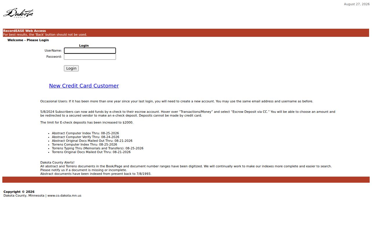
The RecordEASE entry screen shown above is the county’s starting point for the recorder index. For document copies, Dakota County lists $1 per page for ordinary copies and $10 for certified copies. Call 651-438-4597 for page counts and document details. A written request may be mailed to Property Taxation & Records, Attn: Research, 1590 Highway 55, Hastings, MN 55033, with a check payable to PT&R; the county states a 24-hour turnaround for mailed requests.
Abstract and Torrens South St. Paul Records
Dakota County uses Abstract and Torrens land systems, and most county property is Abstract. A Torrens Certificate of Title is described by the county as conclusive evidence of ownership subject to stated exceptions, so a simple deed sequence may not be the whole picture. The property map can show the Abstract/Torrens layer, but it does not itself prove title.
For a Torrens record involving probate, a trust, divorce or SREDJ material, a guardian, bankruptcy, power of attorney, transfer-on-death affidavit, or other complexity, the county directs researchers to the Examiner of Titles. The office is at 1590 Highway 55, Hastings, with Stacy Lofgren listed at 651-437-8933. This is a land-record review path, not an automatic finding about who lived at the address.
South St. Paul Permit History
The city’s ePermit route accepts a permit number or property address after free account registration. It can help date current work categories such as exterior projects, electrical work, HVAC, plumbing, or sewer and water work. Use a permit file as an address-linked municipal record, not a substitute for the land chain or a household list.
There is a firm coverage break: permits before 2014 require a completed data request. South St. Paul directs those requests to permits@sspmn.org, 651-554-3220, City Hall, or mail/in-person delivery at 125 Third Avenue North, South St. Paul, MN 55075. County-controlled right-of-way permits follow Dakota County’s One Stop system and require the exact address. Note: A dated permit can support a property timeline, but it does not prove every person connected to the address.
South St. Paul Past Directory Years
After the land trail supplies an address and period, shift to household evidence. Saint Paul Public Library’s house-history method begins with the street section from 1929 onward, then uses the name section for context. Pair the directory edition with the appropriate census year, followed by newspapers, obituary material, church or cemetery records, and then deed, tax, or GIS material. The historical collections themselves are described in the South St. Paul directory book.
- Write down the address exactly as printed in the deed or parcel source, including direction and street type.
- Check the edition’s street section first when one exists, then find each listed name in the alphabetical section.
- Compare the directory year with a census year held or indexed by DCHS, Lawshe, or another stated repository.
- Use newspapers, cemetery records, and obituaries to test dates and family connections without assuming a single result resolves the household.
The 1929 volume is a useful bridge because it has a separate South St. Paul street index, a pink street index, wives’ names, and a dotted circle marking a homeowner. The 1933 directory lists all adults, while the 1940 volume has only a telephone indicator. Such details explain why one year may reveal more than another. Record edition, page, section, printed street spelling, and whether the entry came from the name or street listing.
South St. Paul Past Residents at Lawshe
The Lawshe Memorial Museum is a practical local stop when an older property trail reaches beyond web indexes. Its research library at 130 3rd Avenue North holds Dakota County and Minnesota histories, newspaper microfilm back to the 1850s, federal and state census material from 1849 to 1940, cemetery and obituary records, church records, plat maps, telephone books, and city directories. The museum also holds oral histories and historical photographs that can add period context after an address or family connection is already documented.
Appointment is encouraged but not required. Call 651-552-7548 before traveling with the exact address, name variants, and date range. Research assistance is free for members, with a stated suggested donation of $15 per half hour for nonmembers. DCHS also reports an online search of more than half a million local records, including church, cemetery, census, and WWI biography material, though it says the searchable set is not complete.
South St. Paul Property Watch
Dakota County Property Watch is a free forward-looking recording alert, not a backfile of previous residents. A subscriber provides a name, entity, or property, legal description, and email. When a matching recording occurs, the county sends an email with the party name, recorded date, document number, and document type. Common names may trigger many results.
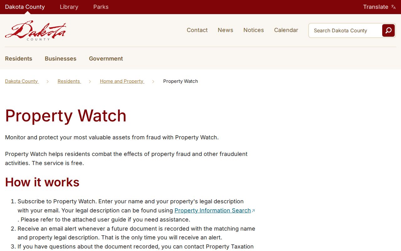
The county page shown above makes the alert useful for monitoring future recordings after a parcel has been identified. It does not fill historical gaps, establish a person’s residence, or replace a deed copy. For a dated South St. Paul history, keep Property Watch separate from RecordEASE, directories, permits, and the historical repositories.
Limits on South St. Paul Address History
Previous residents research is an address history, not a complete account of everyone who used a property. A previous residents result needs its source date, address form, and party role preserved together. The online land index may have an older-record gap, directory conventions change by edition, and a party in a recorded document may have a role unrelated to occupancy. The city has not published a verified citywide historical resident roll, and a distinct South St. Paul Sanborn sheet set was not located in the research. Document the gap, seek the relevant custodian or repository, and avoid filling it with inference.
When dates or street forms conflict, retain the conflict beside the source rather than choosing the more convenient result. County copy requests and local historical repositories are the documented fallback paths for records that are absent from an online screen.
Lawful use. South St. Paul previous-resident records support house history, family history, and personal research. Minnesota law prohibits using information to stalk, harass, or harm another person.