
South St. Paul Neighbors: Block Sources
South St. Paul neighbors are not published in one authoritative block roster. Dakota County's property layer identifies a parcel and its map context. RecordEASE is the recorded-instrument route, while a voter-list request is a controlled state process with permitted uses. City community contacts can connect a person with a public program, but the research did not locate a current public association or HOA member directory. Historical directories and plats can place past households on a block when read with the edition year. Each source answers a narrower question than the word "neighbor" suggests.
| Local source | What it can show around a block | Access route |
|---|---|---|
| Dakota County Property Information | Situs address, parcel ID, municipality, map position, tax and legal-description context | Free online search by address or parcel ID; public owner-name search was not documented |
| Dakota County GIS | Adjacent parcel polygons, streets, aerials, contours, parks, roads, and floodplain context | Online map, Map Catalog, or Western Service Center terminals |
| RecordEASE and recorder | Dated land instruments and party roles connected to a legal description | Account/login route, county copy or research request, and Hastings office |
| Minnesota voter-list request | Controlled current voter-list products by permitted geography and format | Secretary of State form and signed certification, not a public name lookup |
| Local history collections | Dated street, plat, newspaper, and directory context for earlier blocks | Lawshe, DCHS, SPPL, MNHS, or an archive request |
South St. Paul parcel and instrument records can identify land relationships, not every person at an address. A mailing address may differ from the situs address. Likewise, a recorded party, lien claimant, trustee, or document preparer is not automatically a current owner or occupant.
Map South St. Paul Neighbors by Parcel
The Dakota County GIS viewer is the visual starting point for a block question. Search the exact South St. Paul address, then keep the parcel ID, situs address, municipality, map extent, legal description, and Abstract or Torrens indicator together. The property map answers which parcel sits at the address and where it is. It does not establish title or prove residency. For an important recorded document, follow the parcel's legal description or index reference to RecordEASE and obtain a copy through Property Taxation & Records when needed.
- Locate the subject address in Dakota County Property Information by street address or parcel ID. Check the house number, street name, municipality, ZIP, parcel ID, and legal description together.
- Save the date, map scale, and current parcel ID. Values, tax data, map layers, and ownership information can change after a search.
- Open each adjacent parcel one at a time. Record its parcel ID and its position relative to the subject parcel rather than inferring a household from the label.
- Use the recorder index only for the document question that follows. Read parties by their recorded role and date, then order a copy if the index result matters.
- Move to a dated directory or plat only when the question is historical. The South St. Paul street directory follows a whole named street rather than this immediate-block method.
A multi-unit building or shared lot needs extra care. The legal description, a unit indication, city permit material, or a certified document may distinguish premises that look like one point on a map.
South St. Paul Neighbors on Four Sides
Capture a South St. Paul block as a set of relationships, not as a single row of addresses. The county workflow calls for adjacent parcel IDs, streets or alleys, and visible map layers on each side. Across the street is a separate frontage question, not an automatic continuation of the same polygon. For a shared building or lot, use the legal description or unit clue before assuming that a nearby map point represents a separate household.
| Block position | Capture from the map | Follow-up source |
|---|---|---|
| North or upper edge | Adjacent parcel ID, street or alley, and visible layer | Property Information and current city map |
| South or lower edge | Adjacent parcel ID and street or alley | Property Information and current city map |
| East or right edge | Adjacent parcel ID, intersection, and side street | Property Information and current city map |
| West or left edge | Adjacent parcel ID, intersection, and side street | Property Information and current city map |
| Across the street | Address and parcel on the opposite frontage | City map and GIS, without assuming one block polygon |
Keep nearby ZIP labels and city limits in their own fields. Postal geography, parcel geography, and street frontage are useful together, but none of them creates a resident list.
South St. Paul Neighbor Map Layers
Dakota County describes roughly 150 layers in its Interactive GIS Map. Parcel information is only one layer. Aerial photography, contours, county parks and trails, road construction, roundabouts, floodplains, and other public layers can explain why a South St. Paul block's setting or access appears different from an older record. The Map Catalog provides a second county route when a property card is unavailable or a map download is needed; it accepts city, section, grid, USNG, address, and parcel ID searches.
The Mapping Prejudice layer is a separate historical land-record resource. Dakota County says its map is complete for discriminatory covenants, and its agreement began in 2021. It may reveal a covenant-history question tied to a parcel, but it is not a current resident label and should never be treated as one. Keep the layer date, parcel ID, and the underlying source context with any historical note.
South St. Paul Neighbor Community Contacts
The available official material supplies public community contacts, not a guessed association roster. A Southview Hill planning document discusses neighborhood associations, block captains covering roughly 10 to 15 houses, and a watch coordinator. It is a planning recommendation and historical neighborhood study, not proof that a named group or captain remains active. Current city material promotes neighborhood-watch and block-group participation through Night to Unite, but it does not publish a complete member directory.
| Program or organization | Public contact or activity | Directory boundary |
|---|---|---|
| South St. Paul Night to Unite | Annual first-Tuesday-in-August neighborhood event and block-group/watch context; coordinator Deb Griffith, 651-554-3230, deb.griffith@southstpaul.org | Public program contact, not a resident or membership list |
| Neighbors Inc. | Community nonprofit at 222 Grand Avenue West, South St. Paul; 651-455-5000; office Monday through Friday, 9 a.m. to 4 p.m. | Service organization, not a public block directory |
| South St. Paul Open Foundation | Public board and community contact; third-Wednesday 8 p.m. meetings at Croatian Hall | Civic organization, not a neighborhood roster |
| City Community page | Links to the newsletter, Night to Unite, schools, Lions, and community resources | Umbrella resource, with no complete association register located |
No current official South St. Paul neighborhood-association or HOA directory, and no public member lists, were located in the research. Contacting a public program is more accurate than publishing an assumed group name or a private household list.
South St. Paul Neighbor Records Compared
Official South St. Paul records and commercial neighbor-lookup products serve different purposes. County and city sources describe the record they hold, the date of the result, and the route for a copy or correction. Commercial people-finder categories may combine public sources into a profile, but the research warns that such profiles can be inaccurate. A match should be verified with the responsible public custodian, not treated as a conclusion about a person or a current block.
| Source category | Strength | Limit to keep in view |
|---|---|---|
| County parcel and GIS records | Direct parcel geography, documented map layers, parcel ID, and date-specific context | Map labels do not prove occupancy or complete title |
| Recorder index and document copy | Dated instruments and identifiable party roles linked to a legal description | Recorded parties may not be current occupants; older material can require office research |
| Controlled voter-list request | Defined statutory fields, geography, product types, and certification rules | Not a public person search; private fields and protected addresses remain excluded |
| Commercial neighbor tools | May offer a broad starting lead | Can combine stale or mismatched records and does not replace source-level verification |
For a land-history question, preserve the parcel ID, date, and exact party role before requesting a county document copy. For a block question, preserve the map extent and adjacent parcel IDs. Those details make a later correction possible without turning a broad profile into an unverified claim.
Past South St. Paul Neighbors in Archives
For a past block, begin with a date and the address as it appeared at that time. The South St. Paul City Archive has documented controls for keywords, archive type, time period, date range, and browsing. A name can occur in a council paper, license, board packet, or minute without functioning as a resident index entry, so retain the category and date with any hit. Municipal papers may reveal a local address context, but they are not a complete directory of neighbors.
The South St. Paul City Archive search is shown in the captured source image.
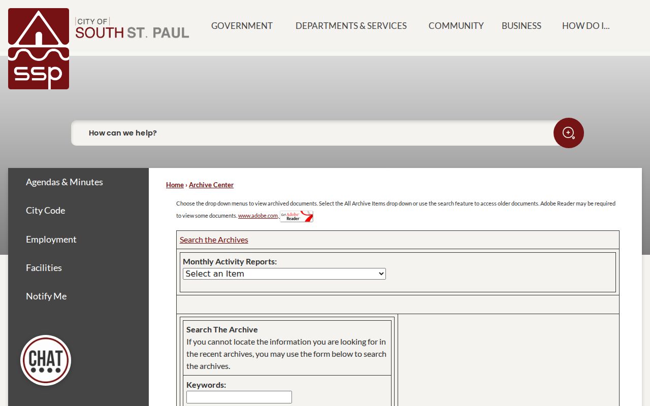
The archive screen supports a dated municipal search, not a household roster. Pair it with directories, plats, and newspapers when the question concerns an earlier South St. Paul block.
Lawshe Memorial Museum at 130 3rd Avenue North holds 1879-present plat maps, telephone books and city directories, local newspapers on microfilm, census material, and other local sources. Call 651-552-7548 with the address and date range; appointments are encouraged but not required. DCHS also has an online Search Records tool with more than half a million partial local records, while SPPL, MNHS, and Lawshe provide additional print, microfilm, or archival paths. A no-result in any one collection is not proof of absence.
South St. Paul Neighborhood Names
Historic neighborhood terms can sharpen an archive search without being mistaken for current association boundaries. The city historical analysis identifies North End, South Park, Central, Roosevelt, South End, Messer Street Flats, and Oak Park. Use those terms in planning records, newspapers, and historical collections alongside the street address and year. The names describe historical or local-area context, not a current official district map and not a list of South St. Paul neighbors.
The 2022 city street map supplies the present visual frame, including Concord, Marie, Southview, and numbered roads. For older work, preserve the printed street spelling and number because an address can be reused, split, or assigned to a different parcel. No official South St. Paul-wide street-renumbering date was located, so an unexplained number change should be documented rather than guessed.
South St. Paul Neighbor Map Help
Online tools are only one South St. Paul route. The Western Service Center in Apple Valley has two public Dakota County Property Information terminals in its main atrium. The GIS office, on the third floor, is open 8:00 a.m. to 4:30 p.m. Monday through Friday except federal holidays; map printing help is available at 952-891-7081 and GIS@co.dakota.mn.us. The county also lists basic line-map fees from $2.90 for 8.5 by 11 inches to $34 for 34 by 44 inches, separate color-aerial prices, and custom GIS work at $82.25 per hour.
For city-linked records, use the City Clerk, planning or permits staff, and the appropriate records-request route rather than assuming that a county map holds the source file. Current permits can be searched through ePermit by permit number or property address; permits before 2014 require a data request through permits@sspmn.org, 651-554-3220, City Hall, or mail. Lawshe, DCHS, SPPL, and MNHS remain the library and archive fallback for directories, plats, newspapers, and historical neighborhood terms. Phone, email, in-person, mail, and request channels are useful when a portal does not show the needed record.
Dakota County Property Taxation & Records provides the recorder and copy route at 1590 Highway 55 in Hastings, reachable at 651-438-4597 and records@co.dakota.mn.us. Dakota County Elections uses the same Administration Center address for election questions at 651-438-4305. These county contacts help route a document or geography question to the office that holds the underlying record.
Privacy Limits for South St. Paul Neighbors
Minnesota's Government Data Practices Act begins with a public-data presumption, but a field can be public in one record and private in another. Ask for the narrowest location and date range needed, and expect redaction where the law requires it. Do not publish full birth dates, Social Security numbers, driver-license or state-ID numbers, protected addresses, confidential birth data, or private contact fields. The state voter material excludes full dates of birth and several identifiers, and Minnesota does not use a conventional public party-registration field.
Safe at Home is Minnesota's address-confidentiality program for eligible people who fear for their safety. It provides a substitute address and confidential voting. If a public record shows that substitute, preserve it as the public record and do not attempt to identify an actual location. A person can also be absent from a public portal because of court, vital, juvenile, victim, or other protected-address rules.
Lawful use. Use South St. Paul neighbor research for personal connection, family history, civic curiosity, or a property question with a lawful purpose. Never use it to stalk, harass, intimidate, or harm anyone.